

Copyright 2025
Morning Rain:
Eureka, California sits on the shore of the mighty Pacific Ocean. Although a logging town in its day, Eureka features a beautiful downtown area with quaint restaurants, shops and parks. And being on the North Pacific, you can expect cold nights, and damp days. Eureka is also known as the "Gateway to the Redwoods" because of its proximity to the world's only Redwood Forests located within the Northern California Coastal mountains. As you drive north out of Eureka, you soon come to the Redwood National and State Parks. When approaching the park from the south on US 101, you would expect to drive through a canopy of towering trees...... BUT..... sadly, Redwood National Park has only one small Grove of Redwood trees left to visit. This is because in years past, nearly ALL of the ancient Redwood groves throughout this region have been cut down.
In 1969, then President Richard Nixon declared that the remaining grove in Redwood National Park be preserved and named "The Lady Bird Johnson Grove", to honor the former first lady's work in conservation and environmental issues. Years later, the National Park Service decided to combine this attraction with several of the California State Parks to insure the preservation of the few ancient Redwood groves that were still left standing.
To me, one of the greatest tragedies in modern times is the destruction of the Ancient Redwood groves. Wealthy and powerful

Lumber Barons in the late 1800's and early 1900's couldn't cut the trees down fast enough, selling the wood at an alarming pace to the highest bidders from around the world. Even today, if not protected, Redwoods are being harvested throughout the region, bringing to an end one of nature's most awesome creations! In a state that touts its environmental agenda, California should be ashamed of how it has managed this natural wonder! Heartbreaking, indeed!
-----------------
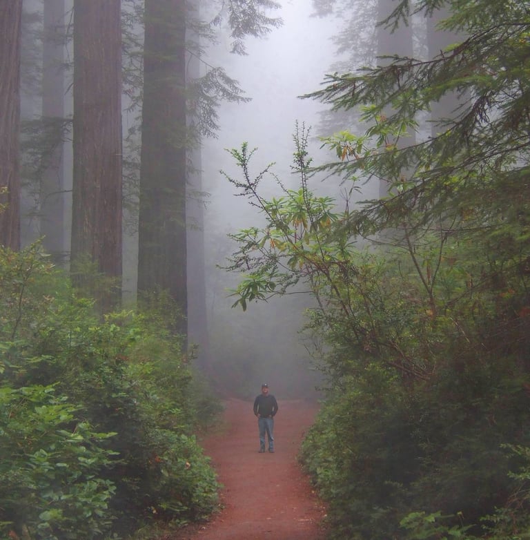
The trail through the Lady Bird Johnson Grove is well maintained and easily walked. However, being located on a mountainside along the North Pacific coast, cold damp morning air is always the norm. While hiking along the trail, a dense marine layer rolled in from the Ocean below, blanketing the grove in a shroud of cool misty air. The savory smells of conifer and cedar filled my senses as a gentle rain began to drip through the trees. I took shelter alongside a strand of ancient trees and recorded the sound of the drops as they blanketed the moss laden forest floor around me......
-------------------
I hope you'll join me for a few moments as my guitar sings a chant to these Ancient Redwood giants, with a prayer that they can at last be at peace with the encroaching world around them.......
Lady Bird Johnson Grove, Redwood National Park, California.
Cape Flattery:
While driving north on US Highway 101, you eventually will end up in northwestern Washington State, and in the bustling little town of Port Angeles. Although there is actually a small port there, Port Angeles is well known because it is the gateway to the amazing Olympic National Park....
And if you happen to be in downtown Port Angeles, you can drive straight south out of town on Race Street, and you'll soon come to the entrance of the "Hurricane Ridge Highway". And for those who dare to take the drive up this twisting mountain road, they are treated to a wonderous and beautiful 17 mile drive into the heart of the Olympic Mountains, with stunning views around every corner.
The Park features jagged mountain peaks covered with snow, and ancient rain forests that blanket the entire western slope of the Olympic range. There are lakes, and streams, and Spruce pines the size of Redwoods. And so remote and rugged are some areas of the park that only a few brave mountaineers have ever traversed into it's realm. It is a natural paradise.
Since Highway 101 circles the Park, most folks get in line and stop at each viewpoint along the way. But, as you drive west out of Port Angeles, there is an unassuming sign that reads "Highway 112". And a quick right turn onto Highway 112 will lead you away from the park...... and to the sea....

Highway 112 has been called the "Straight of Juan De Fuca Highway" as it weaves in and out of the hills along the Straight. And after a slow, twisting 61 mile drive along the water, you will eventually come to the Makah Reservation at Neah Bay. There, you can park your car, and begin to traverse the trail to the most western point in the continental US, Cape Flattery!
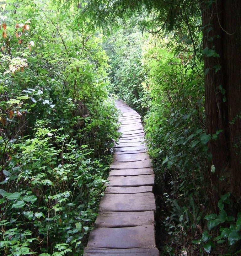
Although the trail is only 3/4 mile long, it winds through thick trees, heavy underbrush, and moss laden live oaks. And since it is located on the northern Pacific coast, the cold, damp, misty ocean air surrounds you with every step. The trail is maintained by the Makah Tribe, who have built steps and boardwalks to aide you in crossing over swampy areas and over slick rocky terrain. At the end of the trail there is a viewpoint gazebo. And it is there that you can stand and look out to the sea. And it is at that point, you are standing on the most western spot in the lower 48 states!
---------------
As I traversed across one of the many boardwalks through the dense rain forest, the rain began to fall all around me. Kneeling down using my raincoat as a shield, I captured the sound of the rain as it danced off the boardwalk, and off of the overhanging trees, and off of me.....
--------------
The song "Cape Flattery" is a musical chant that I had originally used in a different ambient song which has since been retired. Although at times it may seem upbeat, it is intended to sing the song of the natural world, which is wonderous and enlightening at times, but is also helpless and vulnerable to not only natural changes, but to human advancement. And as is the case with all natural things, there is a beginning and there is an end. And it is this reality, as I stand in such a sacred and enchanted place, that saddens me.....
Cape Flattery Trail at Neah Bay, Makah Reservation, Washington
Burney Falls:
Driving north out of Reno on Highway 395, you soon come to the quaint little town of Susanville. As you drive through town, you reach a sharp corner at the end of the downtown area, which turns to the west and climbs up a steep hill........
And although you are still in town, it is at that moment that you have entered into the great Northern California Wilderness area.
And as you drive along, you will soon bump into the incredible Lassen Volcanic National Park. There, you can hike up to the 10,000 ft Lassen summit and peer into the heart of the sleeping caldera! The scenery there is stunning, yet the power of such a huge volcano puts your every step on edge.....
From there, if you head north on Highway 89, you drive through a pristine forest of towering pines. And as you wind around curves and over hills, you get an occasional glimpse of Mt. Shasta towering in the distance. At 14,100 ft, it is the 2nd highest volcano in the Cascade range. And I must say, it is just MASSIVE!!
And as you continue down the highway, you'll soon pass a little sign on the road that says "McArthur-Burney Falls Memorial State Park". A visit to this quiet little park reveals a river that seemingly pops out of the
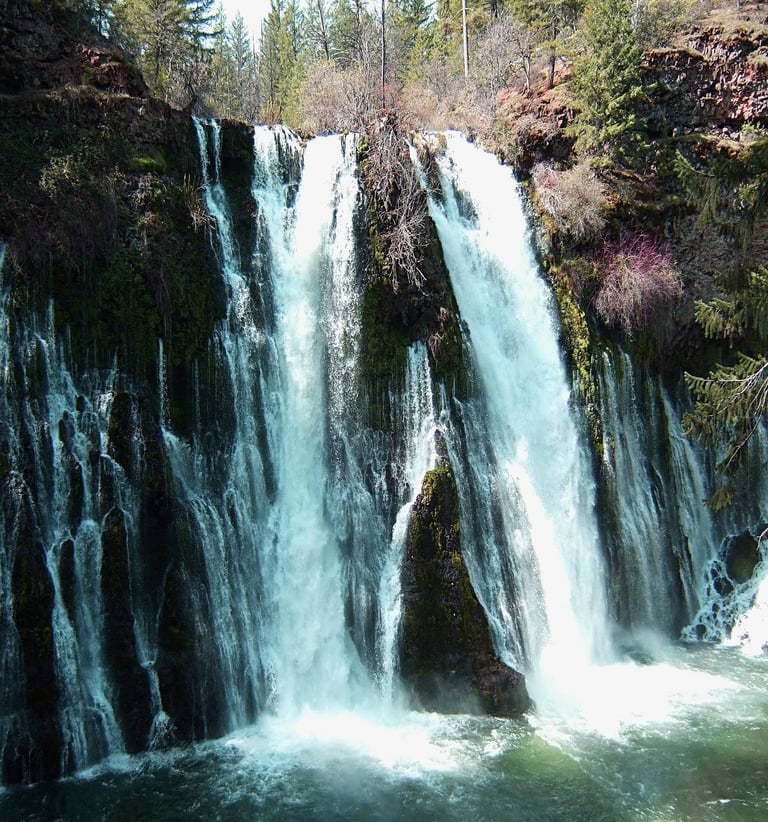

ground , a beautiful rushing river, a sparkling waterfall that appears to flow directly out of the rocks, and a crystal clear lake nestled in the pines. The trail to the Burney Falls winds down a steep hill, offering different panoramic views around every corner, and finally stopping at the base of the falls....... A peaceful, stunning place indeed.
---------
The falls was serene as the sun peeked through the towering trees overhead. As I sat on a mossy rock at the base of the falls, I captured the soothing sounds of the falling water. And I'm quite certain that, as the sun danced in the pooling water below, I caught a glimpse of a Siren dancing in the torrent.....
McArthur-Burney Falls, California.
White Rock Canyon Springs:
If you drive a few miles south of the Hoover Dam on Interstate 11, you will cruise past a small sign on the side of the road that reads "White Rock Canyon Trailhead". Most folks are flying past the sign at 70mph and don't even take the time to read it, much less stop and traverse the trail.
But for the fortunate few who stop and hike the trail, the great wonders and beauty of the White Rock Canyon awaits them. The trail meanders several miles down a slope, through slot canyons and towering cliffs, until it flattens out and settles on the shores of the Colorado River. There, the crystal clear waters of the Colorado whisp on past, with birds chirping, and fish jumping.... It is a serene paradise that is visited by only a few.....
But the trail doesn't end at the rivers edge...... It continues south, twisting around cliffs and over rock formations, until it settles along the banks of a small creek. The creek is caressed by overhanging trees and features a sandy bottom.... perfect for dabbling your tired feet into after a long hike. It is truly an enchanting place, offering shade and tranquility for those who dare to venture this far along the trail.......
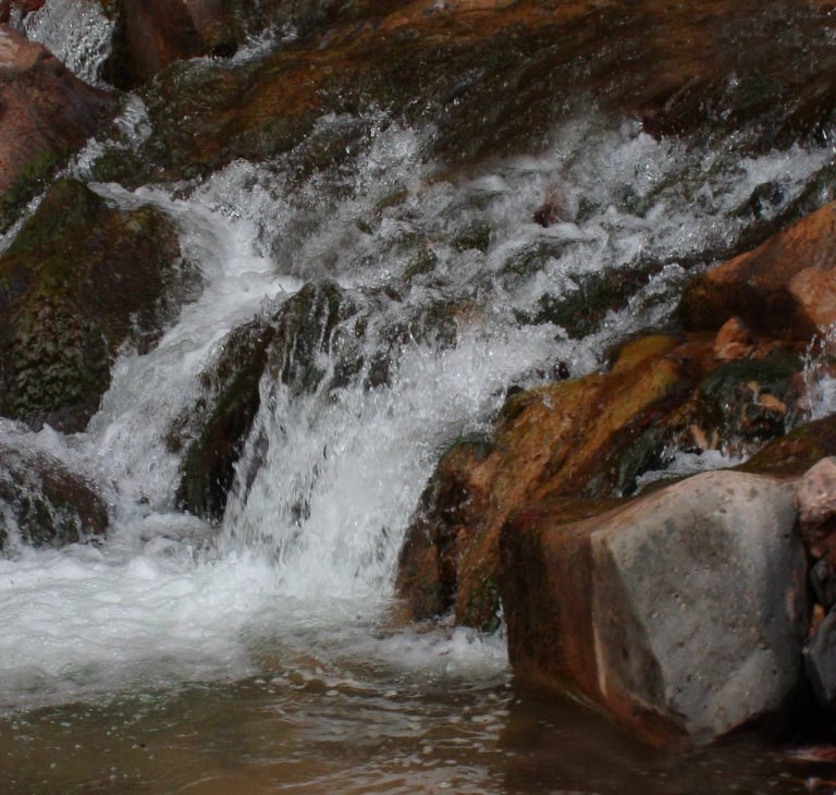

And although this might be trails end - a second glance would bring your eyes to look upstream. There, you will notice that the source of this beautiful stream seems to be flowing directly out of the side of a mountain! And if curiosity becomes you, you can walk along the creek until you reach it's emergence point from a rocky cliff......
And it is there that you have reached the entry point to the amazing White Rock Canyon Springs. Over millions of years, the rushing water has carved a slot canyon right through the middle of the mountain. You can walk along the spring by straddling the sides of the slot canyon walls as the hot water rushes below you. And if you're bold, you will reach the final destination within the canyon which requires a climb up a 15 foot tall ladder to the origin of the springs..... which is a glistening pool of hot water.... It is an amazing place. It is natures gift to all who dare visit.
------------------------
The sound of the water rushing underneath my feet echoes up the canyon walls and surrounded my ears with the crisp and wonderful sounds of the soothing warm rushing waters...... It is there, as I straddled the springs, that my sounds were captured.